The collective spatial practices of shantytown residents in Buenos Aires, their intertwining with State interventions, and the way in which these affect the continuous (re)configuration of the urban territory.
Adriana's current research explores the collective spatial practices of shantytown residents in Buenos Aires, their intertwining with State interventions, and the way in which these affect the continuous (re)configuration of the urban territory. Adriana's thesis looks at shantytowns historically, focusing on a series of case studies located in South-Western Buenos Aires during the period 1958-1972. In her thesis Adriana argues that shantytowns embodied a particularly visible instance of processes that take place more broadly in cities, such as the politicisation implied in any act of urban transformation, the contradictions of modernisation as a top-down practice intended to organise the territory which has often ignored bottom-up initiatives, and the dynamics of spatial actions based on people’s needs.
List of illustrations:
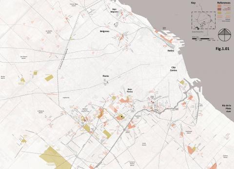
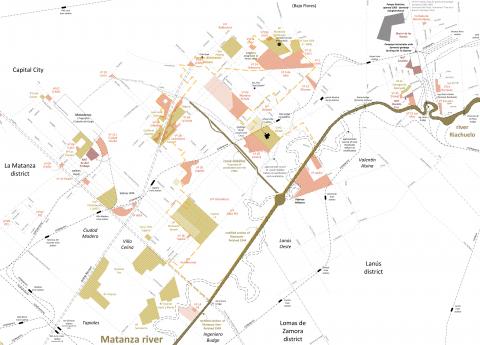
Images 001 and 002. Maps drawn by Adriana Laura Massidda in order to analyse and illustrate the different layers of shantytowns inhabitation in Buenos Aires in 1965. Complexes of social housing and relevant aspects of the urban structure are also included. The maps study and portray with accuracy precisely those features that traditional mappingleaves as invisible, but which were crucial for the way in which the city was experiened and transformed, especially by those with low- or medium-low incomes. In these sense, they have been read by colleagues as complementary to mainstream mapping. The maps have been traced by combining circa thirty primary sources (list available upon request).
- Greater Buenos Aires, including the Capital City and the closest surrounding districts. Background: Plano de la zona urbana del Gran Buenos Aires (Ed. Mapa, 1957). Tracing by Adriana Laura Massidda.
- The South-West of Buenos Aires, including the Capital City and the closest surrounding districts. Tracing by Adriana Laura Massidda.
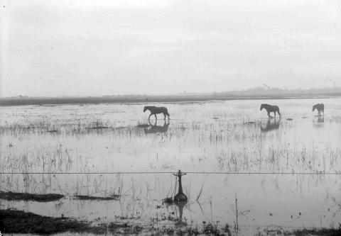
- The South-West marshlands before inhabitation. Source: Archive of the Secretaría de Planeamiento, Gobierno de la Ciudad Autónoma de Buenos Aires.
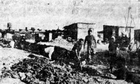
- Residents digging trenches for pipework at shantytown Rotonda Varela. Source: La voz de las villas, February 1965.
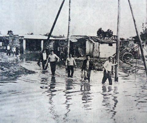
- Villa Jardín in the 1967 flood. Source: Clarín, 13 October 1967
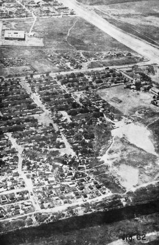
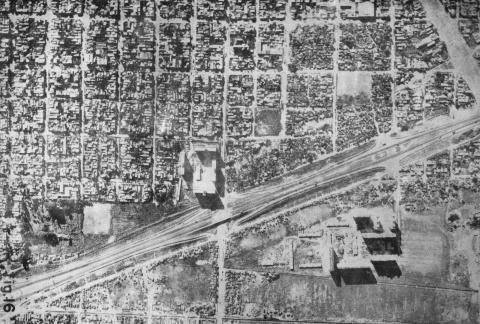
- Barrio Lacarra. Aerial photo taken during municipal survey. Source: GEOS S.R.L. Ing. Consultores, Relevamiento aerofotográfico terrestre en villas de emergencia en la Capital Federal: Villas de emergencia Nos 1; 2; 3; 6; 11; 12; 13a; 13b; 14; 18 y 20. Parque Almirante Brown (Municipalidad de la Ciudad de Buenos Aires, Comisión Municipal de la Vivienda, 1971)
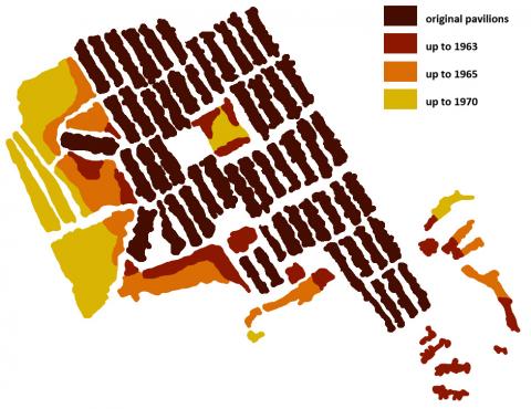
- Analysis of different stages of occupation in Barrio Lacarra. Source: Tracing by Adriana Laura Massidda, based on information from GEOS, Relevamiento...
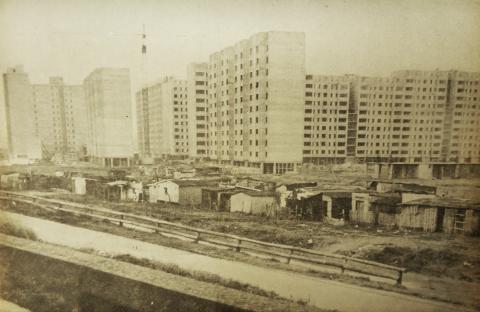
- Villa La Lonja gradually evicted as municipal monoblocks are built on the same site. Source: Comisión Municipal de la Vivienda, Centro Urbano Integrado Parque Almirante Brown: Solicitud de préstamo al Banco Interamericano de Desarrollo, 2 vols. (Buenos Aires: Municipalidad de la Ciudad de Buenos Aires, 1965)
- Intersection of Escalada road and Dellepiane highway. Note Villa La Lonja and monoblocks at the South-east quadrant (towards the bottom-right corner of the image) Source: GEOS, Relevamiento...
All the maps and aerial photos are orientated with the North up.